Project
AHOI : A physical-statistical model of hydrography for fishery and ecology studies
Adjusted Hydrography Optimal Interpolation
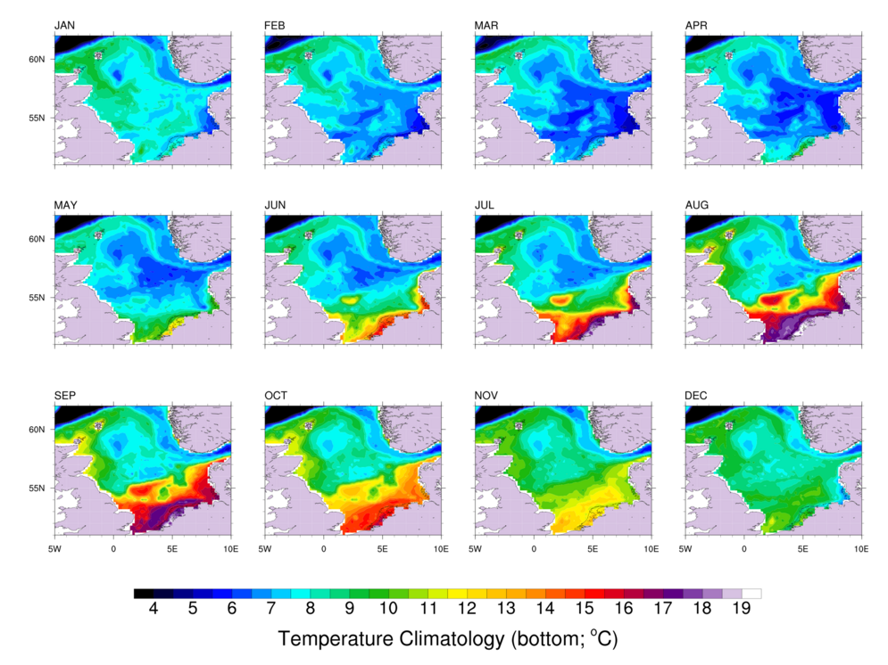
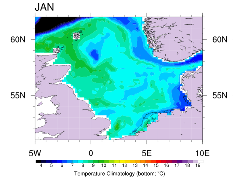
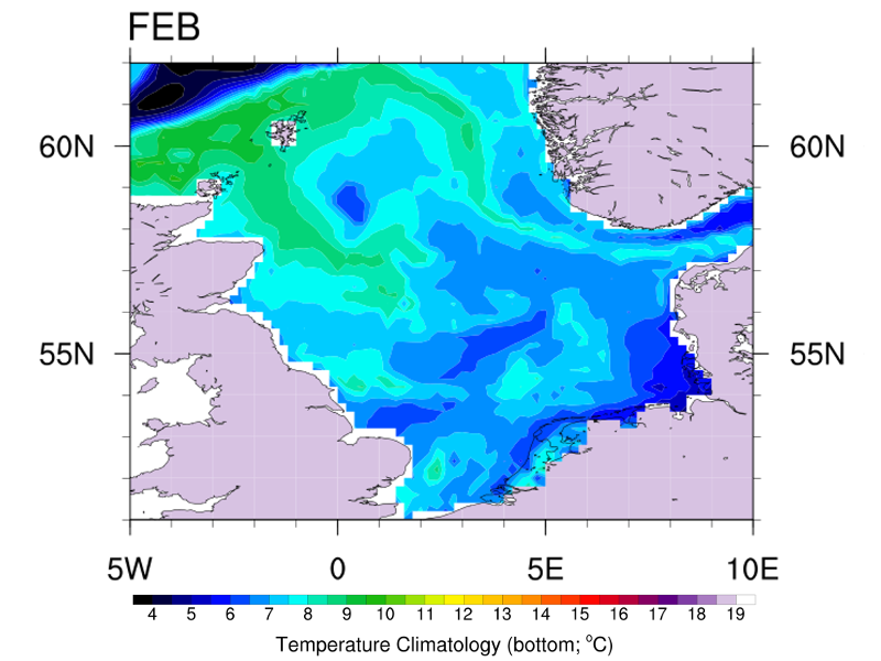
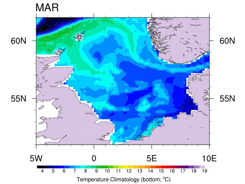
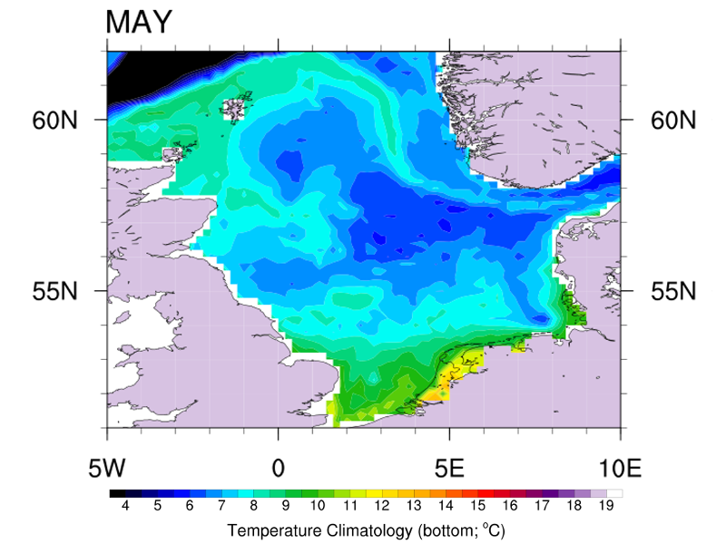
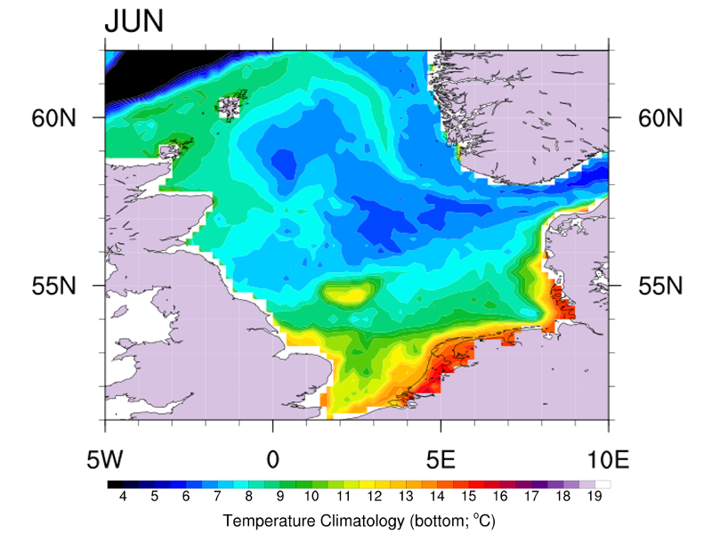
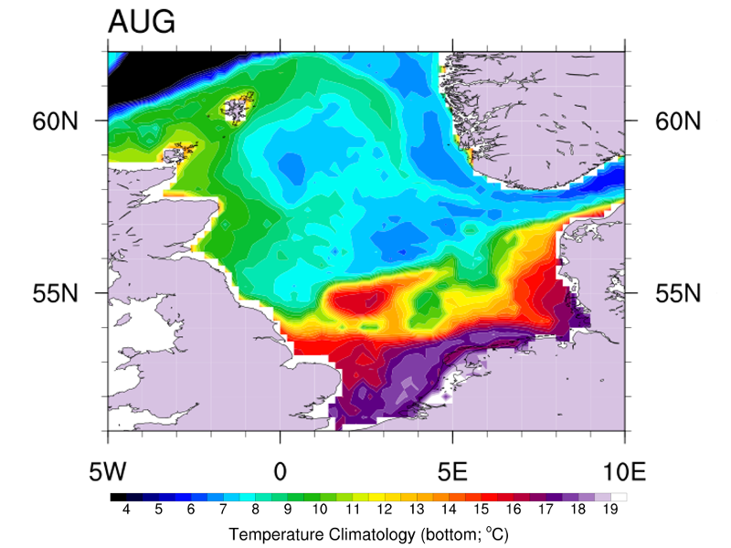
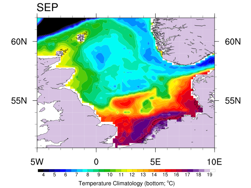
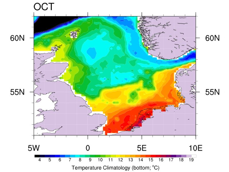
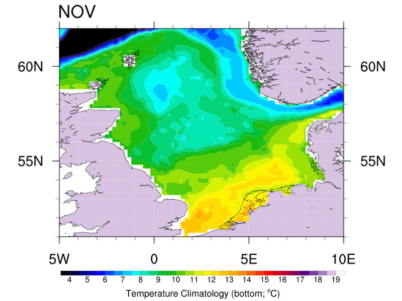
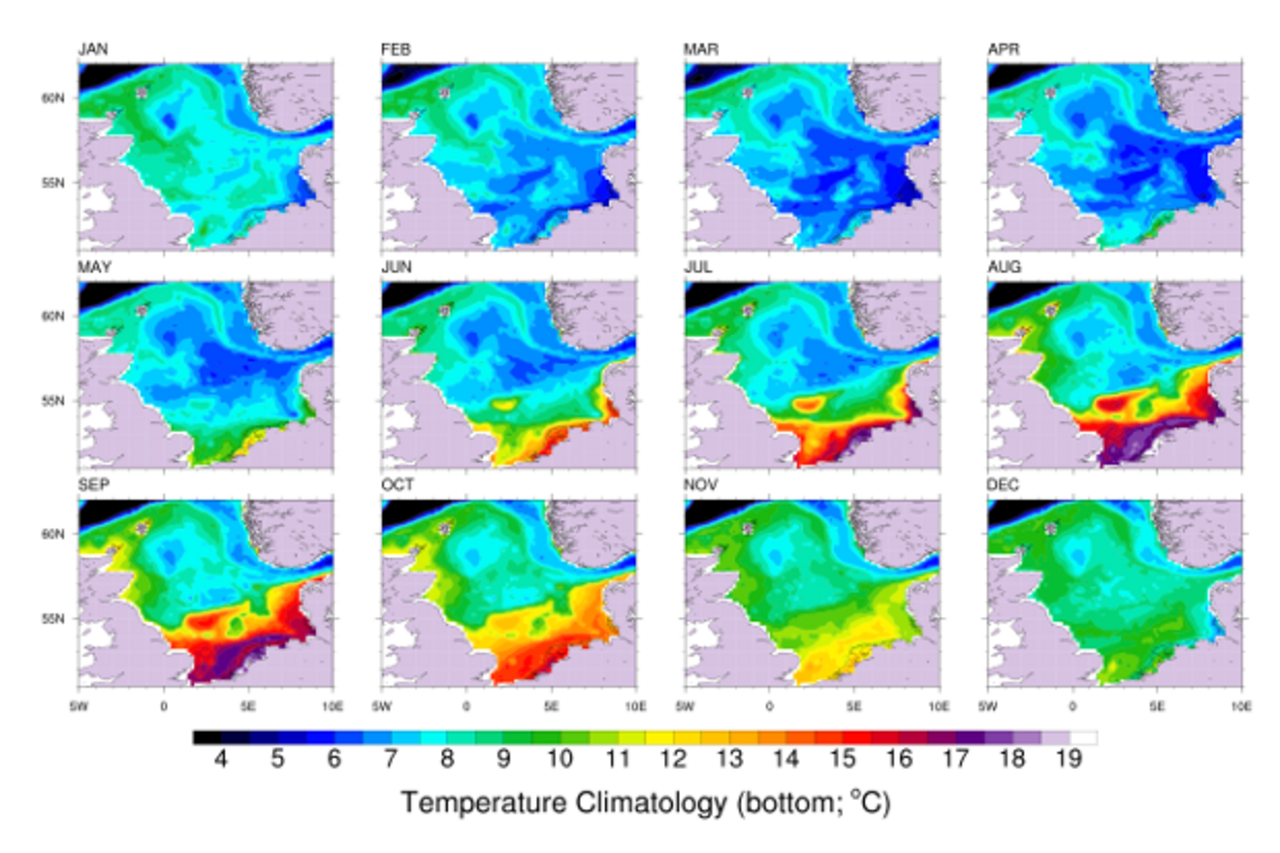
AHOI (Adjusted Hydrography Optimal Interpolation) is a simple physical-statistical model developed in the working group 'Operational Observation Systems' of the Thünen Institute of Sea Fisheries to produce monthly gridded in situ hydrography through various decades. Special care is given to a high vertical resolution, in order to yield a good representation of the near-seabed hydrography due to its importance for marine ecosystems. As a case study we produced monthly maps of
temperature and salinity in the North Sea from 1948 to 2013. This study has been published in Journal of Marine System.
Background and Objective
Ecology and fisheries studies related to climate change demand large amounts of gridded hydrography spanning a long period of time, like decades, with a relatively high sampling frequency, like months. Currently there is not a satisfactory product for such studies in the North Sea, at all depths, with high resolution and freely available to the scientific community. Our goal was to make the best use of available hydrographical data for ecosystem and fisheries studies on inter-annual to multi-decadal timescales and in the frame of climate change.
Approach
AHOI's main steps are:
- Vertical interpolation of hydrographical profiles on common depth levels;
- Identification and removal of outliers by statistical trimming and a buddy-check based on Gauss-Markov or optimal interpolation (OI);
- Mapping of hydrography using OI, independently for each variable (temperature and salinity) and for each depth level;
- Adjustment of poor OI estimates with an harmonic reconstruction arising from the most reliable OI estimates;
- 5. Adjustment of the OI estimates for density stability based on the World Ocean Atlas methods;
Publications
- 0
Oesterwind D, Barrett CJ, Sell AF, Núñez-Riboni I, Kloppmann MHF, Piatkowski U, Wieland K, Laptikhovsky V (2022) Climate change-related changes in cephalopod biodiversity on the North East Atlantic Shelf. Biodiv Conserv 31(5-6):1491-1518, DOI:10.1007/s10531-022-02403-y
- 1
Núñez-Riboni I, Akimova A, Sell AF (2021) Effect of data spatial scale on the performance of fish habitat models. Fish Fisheries 22(5):955-973, DOI:10.1111/faf.12563
- 2
Emblemsvag M, Núñez-Riboni I, Christensen HT, Nogueira A, Gundersen AC, Primicerio R (2020) Increasing temperatures, diversity loss and reorganization of deep-sea fish communities east of Greenland. Mar Ecol Progr Ser 654:127-141, DOI:10.3354/meps13495
- 3
Núñez-Riboni I, Taylor MH, Kempf A, Püts M, Mathis M (2019) Spatially resolved past and projected changes of the suitable thermal habitat of North Sea cod (Gadus morhua) under climate change. ICES J Mar Sci 76(7):2389-2403, DOI:10.1093/icesjms/fsz132
- 4
Van der Sleen P, Stransky C, Morrongiello JR, Haslob H, Perharda M, Black BA (2018) Otolith increments in European plaice (Pleuronectes platessa) reveal temperature and density-dependent effects on growth. ICES J Mar Sci 75(5):1655-1663, DOI:10.1093/icesjms/fsy011
- 5
Núñez-Riboni I, Akimova A (2017) Quantifying the impact of the major driving mechanisms of inter-annual variability of salinity in the North Sea. Progr Oceanogr 154:25-37, DOI:10.1016/j.pocean.2017.04.004
- 6
Akimova A, Núñez-Riboni I, Kempf A, Taylor MH (2016) Spatially-resolved influence of temperature and salinity on stock and recruitment variability of commercially important fishes in the North Sea. PLoS One 11(9):e0161917, DOI:10.1371/journal.pone.0161917
- 7
Núñez-Riboni I, Akimova A (2015) Monthly maps of optimally interpolated in situ hydrography in the North Sea from 1948 to 2013. J Mar Syst 151:15-34, DOI:10.1016/j.jmarsys.2015.06.003
Links and Downloads
Thünen-Contact

Involved Thünen-Partners
Duration
1.2015 - 12.2027
More Information
Project status:
ongoing

![[Translate to English:] [Translate to English:]](/media/_processed_/7/1/csm_IMG_7977_large_1defaf5de1.jpg)

