ThEO

Land use in agricultural landscapes

Marcel Schwieder, Gideon Tetteh, Alexander Gocht, Stefan Erasmi


LV Institute of Rural Studies
BW Institute of Farm Economics

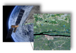
How is agricultural land used and how is its use changing? Satellites of the Copernicus program provide the basis for an area-wide and accurate inventory for the whole of Germany.

In contrast to other available data on land use (e.g. statistics, agricultural subsidy data), remote sensing data cover not only the UAA (UAA), but the entire open landscape (agricultural land, i.e. including uncultivated land).

Remote sensing thus provides the basis for an annual, timely, nationwide and small-scale survey of land use.

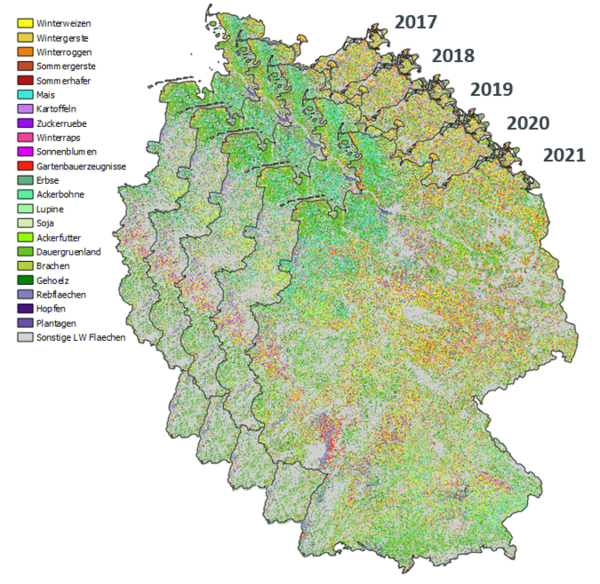
The Thünen Institute produces annual maps of land use in the open landscape for Germany on the basis of freely available satellite data from the Copernicus programme and other satellite data. The work is based on close cooperation with the Humboldt University of Berlin and the Leibniz Centre for Agricultural Landscape Research (ZALF).

The following products are currently available:

  1. Nationwide mapping of the main classes of agricultural land use (from 2017, annually).
  2. Nationwide mapping of grassland mowing for all grassland areas in the broad sense (permanent grassland, arable forage, fallow) (from 2017, annually).

The map products are each generated annually as a raster map (10 x 10 m resolution) and as a vector map (aggregation on automatically derived field boundaries) and can be viewed here. They are available for scientific use and the public on request. An overview of all available remote sensing products as well as the possibilities of data provision is given in the Thünen Earth Observation Atlas.

This information is of importance for example for:

Agricultural statistics

The agricultural structure survey provides aggregated data on land use at intervals of three to four years, which are spatially and temporally disaggregated using estimators and samples. With the spatial data available, the statistical data can be validated and the procedures and results retrospectively optimised.

The EU agricultural policy

A core objective of the Common Agricultural Policy (CAP) of the EU member states is to improve the condition and use of natural resources in the agricultural landscape. Satellite-based maps can help to understand the effectiveness of CAP measures, e.g. by showing changes in land use, crop diversity or landscape structure.

Projects

Automatic determination of grassland use intensities by means of satellite image time series

Nationwide information on grassland use intensity is still unknown in Germany. Remote sensing data can help to close this knowledge gap in the future.

More
Automatic determination of grassland use intensities by means of satellite image time series

Copernicus lights green

Land consumption and intensification of use exert high pressure on grassland areas. Recording and assessing the condition and distribution of protected grassland and grassland worthy of protection requires a great deal of effort. In the future, satellite data should support official monitoring with area-wide services.

More
Copernicus lights green

Development of an automated support system to monitor agricultural funding and compensation sites (timeStamp)

Site-related measures in the agricultural funding and the intervention scheme are currently checked with time - and cost-intensive on spot checks. A Web application, based on remote sensing data, should change that.

More
Development of an automated support system to monitor agricultural funding and compensation sites (timeStamp)

Earth observation and artificial intelligence for monitoring of organic farming

By 2030, the share of organic farming in Germany aims to be expanded to 30% of agricultural land. Satellite data can help to show cultivated areas and differences in management practices between organic and conventional farming.

More
Earth observation and artificial intelligence for monitoring of organic farming

I spy with my little eye: automated detection of agricultural parcels and crops using satellite images

German-wide and plot-specific land use data is so far not public available. This can change due to the new data from satellite imagery from the Copernicus program (Sentinel), which is free and taken at a high frequency.

More
I spy with my little eye: automated detection of agricultural parcels and crops using satellite images

Monitoring biological diversity in agricultural landscapes with remote sensing

A long-term monitoring of biological diversity at national level requires a representative data basis about the state and development of agricultural landscape. To achieve this, the project MonViFE develops spatially explicit indicators of landscape structure and land-use intensity.

More
Monitoring biological diversity in agricultural landscapes with remote sensing

Remote sensing for improved climate reporting (KlimaFern)

Land use and agricultural measures are essential domains for achieving climate protection targets. Satellite data will be used to monitor agricultural land use over a wide area and to improve the data basis for reporting.

More
Remote sensing for improved climate reporting (KlimaFern)

Scroll to top